Area Overview for Aspley Ward
Photos of Aspley Ward
Area Information
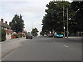
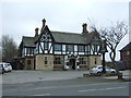
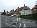
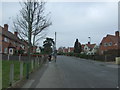
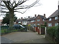
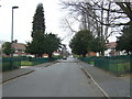
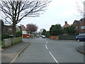
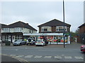
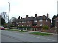
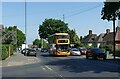
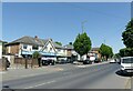
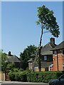
Living in Aspley Ward offers a distinctive experience within Nottingham, located approximately 3 miles west of the city centre. This electoral ward covers a compact 2.9 km² and serves as a residential neighbourhood bordered by Bulwell to the south, Basford to the west, and Bilborough to the north. The A610 acts as the main road, providing a primary route through the area. Historically, the location evolved from small settlements including Aspley Hall and Broxtowe Hall into a large council housing estate developed by Nottingham City Council in the early 20th century. This transformation addressed inner-city slums following land purchases from 1928 onwards. The completed housing scheme was significantly shaped by the post-war landscape, completing plans that were paused during World War II. St Margaret's Church on Aspley Lane, consecrated in 1936, stands as a notable feature alongside the former site of the Aspley Cinema, which opened in 1932. You will find a settled community defined by this planned estate layout and significant historical roots dating back to monks displaced in 1538. The ward represents a specific slice of Nottingham's urban history where residential planning met societal needs over a century ago.
- Area Type
- District Borough Unitary Ward
- Area Size
- 2.9 km²
- Population
- 1727
- Population Density
- 593 people/km²
Demographics
The community profile for Aspley Ward is defined by a high proportion of older residents, with a median age of 70 years. This demographic shift indicates a population heavily weighted towards seniors. The ward accommodates a total population of 1727 people, which is distributed across an area with a density of 593 people per km². Home ownership rates stand at 42%, meaning a significant majority of residents do not own their homes outright. Renting remains the primary form of tenure in this district. Household composition and accommodation type data are recorded as total figures, reflecting the comprehensive nature of available demographic breakdowns. The ward shows little divergence from broader local trends regarding ethnicity and religion, as the predominant groups are recorded without specific minority segmentation in the current data. Deprivation metrics are not explicitly detailed beyond the ownership split. The age structure suggests a quieter residential environment where many households are likely occupied by a single senior resident or couples. This population profile influences local service usage and the general pace of daily life within the ward's boundaries.
Household Size
Accommodation Type
Tenure
Ethnic Group
Religion
Household Composition
Age
Household Deprivation
NS-SEC
Explore more demographic insights in this area
Go to Demographics tabPlanning
Planning Constraints
- Flood RiskPremium
- Ramsar Wetland SitesPremium
- Area of Outstanding Natural BeautyPremium
- Protected Nature ReservePremium
- Protected WoodlandPremium
- Crime RiskPremium