Area Overview for Ashfields Ward
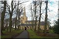
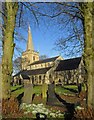
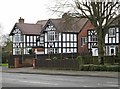
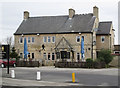
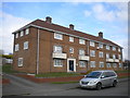
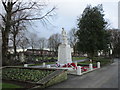
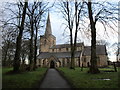
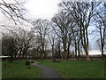
Photos of Ashfields Ward
Area Information
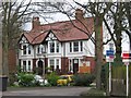
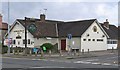
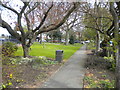
Living in Ashfields Ward offers a distinct experience within a district borough unitary ward in England. This compact area covers just 1.8 km², creating a tightly knit neighbourhood where daily life moves at a considered pace. The neighbourhood attracts those seeking stability and a settled environment, evidenced by the significant portion of existing residents who have put down roots for decades. Prospective homebuyers will find Ashfields Ward to be a place defined by its established character rather than rapid development. You are stepping into a community where the local rhythm is set by long-term inhabitants rather than transient populations. The small physical footprint means amenities are close, and the sense of locality is strong. Residents value this proximity, knowing that their immediate surroundings are familiar and manageable. When considering Ashfields Ward, you are looking at a specific slice of the district that prioritises order and established living patterns over expansion. This focus on a defined, small area suggests a community identity that looks after its own. The ward represents a stable microcosm within the wider borough, offering a clear and uncomplicated entry point for those prioritising privacy and a quiet street life.
- Area Type
- District Borough Unitary Ward
- Area Size
- 1.8 km²
- Population
- Not available
- Population Density
- Not available
Demographics
The community in Ashfields Ward reflects a settled population with a clear demographic profile. The median age stands at 70 years, indicating that the neighbourhood is significantly older than the national average. This age dominance shapes the daily rhythm of the area, with schools near Ashfields Ward likely serving a smaller proportion of young families compared to newer districts. Nearly three-quarters of households, specifically 76%, are owner-occupied underscore the stability within the community. This high rate of home ownership suggests that residents have chosen to build their lives in Ashfields Ward and are unlikely to move frequently. The low rate of renting aligns with the older age profile, as many current residents purchased their homes in earlier decades. You will find a population that has matured alongside the ward, creating a consistent social fabric. The household composition is dominated by these older, property-owning families who have weathered economic changes together. While specific ethnic and religious breakdowns are not detailed in the current records, the demographic weight clearly leans towards an established demographic. This consistency provides a predictable environment for anyone contemplating a move to the area.
Household Size
Accommodation Type
Tenure
Ethnic Group
Religion
Household Composition
Age
Household Deprivation
NS-SEC
Explore more demographic insights in this area
Go to Demographics tabPlanning
Planning Constraints
- Flood RiskPremium
- Ramsar Wetland SitesPremium
- Area of Outstanding Natural BeautyPremium
- Protected Nature ReservePremium
- Protected WoodlandPremium
- Crime RiskPremium