Area Overview for Ashby Parva
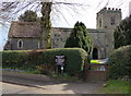
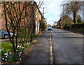
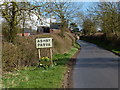
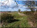
Photos of Ashby Parva
Area Information
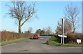
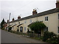
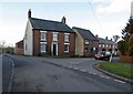
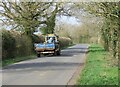
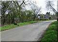
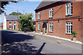
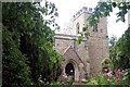
Living in Ashby Parva offers a distinct rural experience within a civil parish that spans just 5.5 km². This small settlement provides an intimate setting where residents enjoy proximity to amenities while maintaining a connection to the countryside. The location suits those who value quiet living spaces over urban convenience. Daily life here revolves around a stable, established community rather than rapid development or transient populations. Prospective buyers looking for homes in Ashby Parva should note the compact nature of the parish, which limits expansion but preserves immediate neighbourhood character. The area does not contain protected planning constraints like Areas of Outstanding Natural Beauty or Ramsar wetland sites, which simplifies the planning landscape compared to more restricted rural locations. You will find a neighbourhood defined by its manageable size and long-term residential stability. The absence of major environmental restrictions allows for straightforward property management while retaining the natural appeal of the Leicestershire Wolds. This parish represents a practical choice for individuals seeking a traditional English village setting without the regulatory hurdles often found in larger conservation areas.
- Area Type
- Parish
- Area Size
- 5.5 km²
- Population
- Not available
- Population Density
- Not available
Demographics
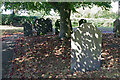
The community in Ashby Parva is exceptionally mature compared to the national average. The median age for residents reaches 70 years, indicating a population dominated by older adults. Most households consist of elderly couples or individuals living alone rather than young families with children. This demographic profile creates a very static social environment where established routines persist through the years. Home ownership stands at an impressive 83%, meaning the vast majority of people living in Ashby Parva own their properties outright or with a mortgage. This high rate contrasts sharply with typical urban rental markets and suggests a community invested in local stability. Accommodation types reflect this ownership model, with detached and semi-detached homes forming the bulk of the housing stock. While specific data on predominant ethnic groups and religious affiliation is not detailed in the provided figures, the overall picture points to a homogeneous, long-resident population. The demographic structure supports a slower pace of life where social interactions are frequent but change slowly over time. For those considering living in Ashby Parva, expect a community history that stretches back decades with minimal influx of new transient populations.
Household Size
Accommodation Type
Tenure
Ethnic Group
Religion
Household Composition
Age
Household Deprivation
NS-SEC
Explore more demographic insights in this area
Go to Demographics tabPlanning
Planning Constraints
- Flood RiskLocked
- Ramsar Wetland SitesLocked
- Area of Outstanding Natural BeautyLocked
- Protected Nature ReserveLocked
- Protected WoodlandLocked
- Crime RiskLocked