Area Overview for Ashby Money Hill Ward
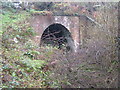
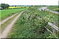
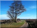
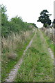
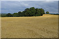
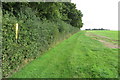
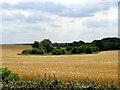
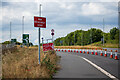
Photos of Ashby Money Hill Ward
Area Information
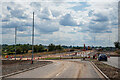
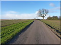
Ashby Money Hill Ward is an electoral ward within the market town of Ashby-de-la-Zouch, located in North West Leicestershire. This district spans 8.3 km² and borders Derbyshire and Staffordshire. It forms one of six wards on the Ashby-de-la-Zouch town council, where three councillors represent the area. The ward also serves as one of the 38 wards under the Leicestershire district council. A typical postcode for this location begins with LE6, such as LE65 1LS. The area sits near the geographical coordinates of 52.7616°N, 1.4555°W. Outside the ward, the A42 and A511 bypasses manage traffic flow away from the town centre, replacing older routes like the A50 and A453. Nearest transport links include train stations in Burton-on-Trent and Tamworth. East Midlands Airport lies to the north-east. Living in Ashby Money Hill Ward offers proximity to these major roads and railway connections while remaining within a managed electoral district. The ward functions as a specific administrative unit within a larger local government structure.
- Area Type
- District Borough Unitary Ward
- Area Size
- 8.3 km²
- Population
- Not available
- Population Density
- Not available
Demographics
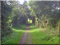
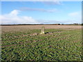
The community within Ashby Money Hill Ward has a median age of 70 years. This indicates a population skewed significantly towards older adults compared to the national average. Age data shows the most common category is total age, confirming the concentration of older residents. Home ownership stands at 73%, meaning nearly three out of four homeowners in the ward own their properties outright or with a mortgage. This high rate is distinct from younger, rental-heavy market towns. Accommodation types rely on total household data without specific breakdowns of flats or terraced versus semi-detached homes. The ward does not report on predominant ethnic groups or religious compositions, suggesting a relatively homogeneous or under-recorded demographic profile in available public datasets. Planning constraints note that the area contains protected woodland, which may influence local development and nature walks. For those seeking homes in Ashby Money Hill Ward, the profile suggests a retirement-focused community rather than a family centric hub.
Household Size
Accommodation Type
Tenure
Ethnic Group
Religion
Household Composition
Age
Household Deprivation
NS-SEC
Explore more demographic insights in this area
Go to Demographics tabPlanning
Planning Constraints
- Flood RiskPremium
- Ramsar Wetland SitesPremium
- Area of Outstanding Natural BeautyPremium
- Protected Nature ReservePremium
- Protected WoodlandPremium
- Crime RiskPremium