Area Overview for Ashby Ivanhoe Ward
Photos of Ashby Ivanhoe Ward

Area Information
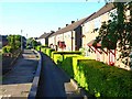
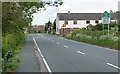
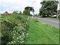
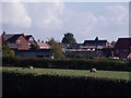
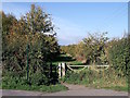
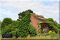
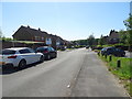
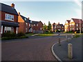
Ashby Ivanhoe Ward sits within the North West Leicestershire district of Leicestershire, England, forming part of the wider East Midlands region. This electoral ward covers a modest geographical area of 3.0 square kilometres, offering a compact setting for residents to navigate. Living in Ashby Ivanhoe Ward means establishing a home in a space defined by its specific boundary characteristics rather than sprawling urbanisation. The ward is identified by the ONS code E05010093, which classifies it as a district borough unitary ward. Your daily life here is shaped by this specific locality, where the physical scale keeps distances manageable. The name suggests proximity to Ashby, a reference point that anchors the ward's identity within the local settlement hierarchy. While the ward does not encompass vast tracts of land, the boundaries are clearly defined for administrative purposes. You will find yourself in a setting that blends rural and suburban elements typical of this part of the county. The area's small footprint means that amenities are likely within reach, fostering a sense of community despite the specific lack of population density data in the provided records. When you consider living in Ashby Ivanhoe Ward, you are choosing a defined microcosm of North West Leicestershire with a precise footprint and established administrative identity.
- Area Type
- District Borough Unitary Ward
- Area Size
- 3.0 km²
- Population
- Not available
- Population Density
- Not available
Demographics
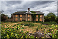
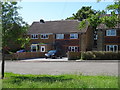
The community profile of Ashby Ivanhoe Ward reveals an older demographic structure. The median age in this ward stands at 70 years, indicating that the population is significantly older than the national average. This age distribution suggests the ward attracts retirees or long-term residents who have stayed in the area. The data specifies the most common age range as 'Total', which implies a focus on the aggregate age figure rather than segmented younger cohorts. Home ownership is a prevalent feature of the ward, with a home ownership rate of 67%. This high percentage indicates that a majority of households have purchased their properties outright or via mortgage, reflecting stability within the local community. There are no specific figures provided regarding household composition, predominant ethnic groups, religion, or detailed accommodation types. These missing metrics mean the specific cultural or religious makeup of the ward remains opaque in this dataset. However, the high ownership rate and older median age paint a picture of settled residents. When looking at homes in Ashby Ivanhoe Ward, you can expect an environment where inheritance or retirement savings may play a larger role in housing decisions. The demographic data confirms this is an area where people tend to stay and remain owners of their property over long periods.
Household Size
Accommodation Type
Tenure
Ethnic Group
Religion
Household Composition
Age
Household Deprivation
NS-SEC
Explore more demographic insights in this area
Go to Demographics tabPlanning
Planning Constraints
- Flood RiskPremium
- Ramsar Wetland SitesPremium
- Area of Outstanding Natural BeautyPremium
- Protected Nature ReservePremium
- Protected WoodlandPremium
- Crime RiskPremium