Area Overview for Ashby de la Launde, Digby & Scopwick Ward
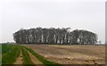
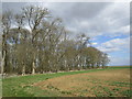
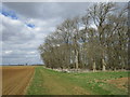
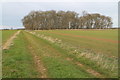
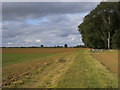
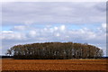
Photos of Ashby de la Launde, Digby & Scopwick Ward
Area Information
Ashby de la Launde, Digby & Scopwick Ward forms a district council unitary ward in North Kesteven, Lincolnshire. This area spans 73.7 km² and sits within the East Midlands region of England. The ward encompasses the civil parishes of Ashby de la Launde and Bloxholm, along with the southern portion of Scopwick Heath. Administratively, the territory includes the adjacent parish of Temple Bruer and the settlement of Temple High Grange. You are located between the towns of Lincoln and Sleaford, with the road network straddling the A15 motorway at coordinates approximately 53.07°N 0.42°W. Living in this specific combination of villages means navigating a landscape shaped by local history and strategic positioning. You can walk past the Knights Templar ruins to the west of the A15 or visit the Alignment of the former Roman road High Dyke along the western edge of Temple Bruer parish. Named entities like RAF Digby, Tedder primary school, and Home Farm anchor the local geography. The ward includes specific residential clusters near Heath Road and Cuckoo Lane. This overview establishes the physical boundaries and administrative status of your future home, removing any ambiguity about exactly where you will be residing within North Kesteven.
- Area Type
- District Borough Unitary Ward
- Area Size
- 73.7 km²
- Population
- Not available
- Population Density
- Not available
Demographics
The community in Ashby de la Launde, Digby & Scopwick Ward displays a distinct age profile influenced by the local housing stock. Residents typically have a median age of 70 years, indicating a significant older retiree population. Demographic analysis shows this pattern across the total age range within the ward. You are joining an area where life moves at a slower pace compared to urban centres. Home ownership rates stand at 63%, meaning roughly six out of ten households own their property outright or with a mortgage. This high proportion of owner-occupied homes suggests financial stability among current residents. Household composition data classifies the total number of residents within the standard categories used for census reporting. No specific breakdown for single-person, couple, or multi-generational households is available in the current dataset, so you cannot determine the exact mix of family sizes. The predominant ethnic group and religious affiliation are recorded as total figures, meaning the broad demographic profile aligns with regional standards without requiring unique descriptors. For a homebuyer, this indicates a traditional English rural demographic typical of Lincolnshire. The absence of complex diversity markers suggests a homogeneous population. Understanding these demographics helps you anticipate who your neighbours might be and what local activities could draw crowds.
Household Size
Accommodation Type
Tenure
Ethnic Group
Religion
Household Composition
Age
Household Deprivation
NS-SEC
Explore more demographic insights in this area
Go to Demographics tabPlanning
Planning Constraints
- Flood RiskPremium
- Ramsar Wetland SitesPremium
- Area of Outstanding Natural BeautyPremium
- Protected Nature ReservePremium
- Protected WoodlandPremium
- Crime RiskPremium