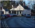
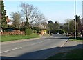
Area Overview for Anstey Ward
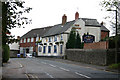
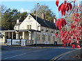
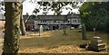
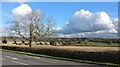
Photos of Anstey Ward


Area Information
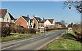
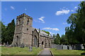
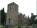
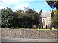
Living in Anstey Ward offers a settled lifestyle within a compact district borough unitary ward covering exactly 5.0 km². You will find a neighbourhood defined by stability rather than rapid change, which reflects its status as a mature part of England. The area is notable for having particularly high rates of long-term residency, indicated by the demographic profile. Prospective buyers might appreciate that daily life here revolves around established routines rather than the development of new estates. Because the ward is relatively small, you likely know many of your neighbours or can quickly become part of the local fabric. The character of Anstey Ward stands out from more transient urban zones nearby. Residents here typically value peace of mind and familiarity over proximity to high-energy nightlife or constantly shifting trends. This quiet existence suits those seeking a place to downsize, downshift, or enjoy a slower pace of life without sacrificing access to surrounding amenities. The physical boundaries of the ward ensure that everything feels manageable on foot or a short drive from your front door. When you consider homes in Anstey Ward, you are entering an environment where community ties are strong and the overall atmosphere remains calm throughout the year.
- Area Type
- District Borough Unitary Ward
- Area Size
- 5.0 km²
- Population
- Not available
- Population Density
- Not available
Demographics
The community profile of Anstey Ward is distinct, with a median age of 70 years. This figure places the area significantly older than the national average, suggesting it serves primarily as a retirement destination or a place where families raise children before moving elsewhere. The age structure implies that you are likely to encounter retirees and older adults rather than large numbers of young children in mainstream neighbourhood settings. While the most common age range is listed simply as 'Age: Total', the median confirms the dominance of the senior demographic. Home ownership stands at 76%, which creates a very stable residential market. You will find a high proportion of long-term residents who have lived in their properties for decades, contributing to a quiet, predictable street scene. Accommodation types and the predominant ethnic group and religion data indicate a generally uniform population, likely reflecting the specific historical development patterns of the ward. With such a high level of ownership, there is less short-term turnover than in private rental sectors. This consistency means schools near Anstey Ward may cater to a family demographic that has relocated with their children over time before the parents grew older.
Household Size
Accommodation Type
Tenure
Ethnic Group
Religion
Household Composition
Age
Household Deprivation
NS-SEC
Explore more demographic insights in this area
Go to Demographics tabPlanning
Planning Constraints
- Flood RiskPremium
- Ramsar Wetland SitesPremium
- Area of Outstanding Natural BeautyPremium
- Protected Nature ReservePremium
- Protected WoodlandPremium
- Crime RiskPremium