Area Overview for Annesley Woodhouse
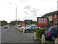
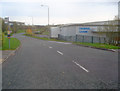
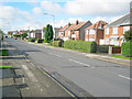
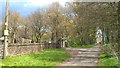
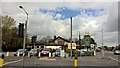
Photos of Annesley Woodhouse


Area Information
Annesley Woodhouse is a compact built-up area spanning 2.2 km², situated in England. Its population profile suggests a community skewed towards older residents, with a median age of 70. This demographic shapes the area’s character, where daily life is likely defined by a slower pace and established routines. Homeownership is strong, with 76% of residents owning their properties, indicating a stable, long-term presence. The area is well-served by a mix of retail, rail, and metro connections, offering practical access to essentials. Schools like Kirkby Woodhouse Primary and Annesley Primary, both rated 'good' by Ofsted, cater to local families. For commuters, nearby stations such as Newstead Railway Station and Butler’s Hill Tram Stop provide reliable transport links. Living here means balancing proximity to amenities with a sense of quiet community, where the older demographic and robust infrastructure create a distinct, functional environment.
- Area Type
- Built Up Area 250
- Area Size
- 2.2 km²
- Population
- Not available
- Population Density
- Not available
Annesley Woodhouse offers a range of amenities within practical reach. Retail options include Co-op Skegby, Morrisons Daily Kirby, and Aldi West Kirkby, providing access to groceries and everyday essentials. The area’s rail and metro stations, such as Sutton Parkway Railway Station and Bulwell Forest Tram Stop, connect residents to broader networks, facilitating commuting and exploration. Parks and green spaces are not explicitly mentioned, but the presence of multiple transport stops suggests proximity to recreational areas. The combination of retail, transport, and community-focused infrastructure creates a convenient lifestyle, where daily needs are met without the need for long journeys. For residents, the balance of accessibility and local services contributes to a practical, low-stress environment.
Amenities
Schools
Annesley Woodhouse is served by three schools, including Kirkby Woodhouse Primary and Nursery, which caters to younger children, and Annesley Primary and Nursery School, rated 'good' by Ofsted. Kirkby Woodhouse School, an academy also rated 'good,' provides secondary education. This mix of primary and academy schools offers families a range of educational options, from early years to secondary levels. The presence of two 'good' rated schools suggests a commitment to quality education, though no data on pupil performance or catchment areas is available. For parents, the proximity of these schools to the area is a practical advantage, reducing commuting times. The variety of school types may also accommodate different educational preferences, from traditional primary schooling to academy-based structures.
| Rank | A + A* % | School | Type | Entry gender | Ages |
|---|---|---|---|---|---|
| 1 | N/A | Kirkby Woodhouse Primary School and Nursery | primary | N/A | N/A |
| 2 | N/A | Annesley Primary and Nursery School | primary | N/A | N/A |
| 3 | N/A | Kirkby Woodhouse School | academy | N/A | N/A |
Explore more schools in this area
Go to Schools tabDemographics
Annesley Woodhouse has a median age of 70, the highest in the dataset, suggesting a population where older adults form a significant proportion. The most common age range is listed as 'Age: Total,' which may reflect aggregated data but highlights the area’s demographic concentration. Homeownership is high at 76%, indicating a community of long-term residents rather than a transient rental market. The data does not specify household types or ethnic diversity, but the overall composition appears homogeneous. With no explicit figures on deprivation or income levels, it is unclear how this affects quality of life. However, the high home ownership and stable age profile suggest a low turnover of residents, fostering a sense of continuity. For those considering the area, understanding its older demographic is key to assessing whether it aligns with their lifestyle needs.
Household Size
Accommodation Type
Tenure
Ethnic Group
Religion
Household Composition
Age
Household Deprivation
NS-SEC
Explore more demographic insights in this area
Go to Demographics tabPlanning
Planning Constraints
- Crime RiskLocked