Area Overview for Annesley
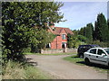
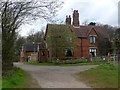
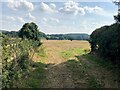
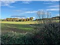
Photos of Annesley
Area Information
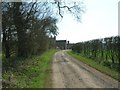
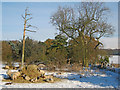
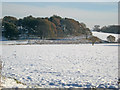
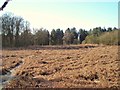
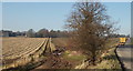
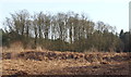
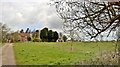
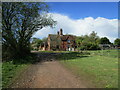
Living in Annesley offers a distinct experience within a civil parish that spans 12.6 km². You are stepping into a settled rural environment where daily life moves at a deliberate pace. The parish sits in England, providing a quiet backdrop that contrasts with the busier towns nearby. While the area does not contain Ramsar wetland sites or Areas of Outstanding Natural Beauty, it features protected woodland which shapes the local landscape. You should be aware that the settlement has a specific character shaped by its demographics, making it different from urban neighbourhoods. There is no ambiguity about the setting; it is a defined civil parish with a clear boundary and a specific size. The environment is processed by planning constraints, yet the land remains accessible for those seeking a ground-level connection to nature in the English countryside. The area size places it firmly in the smaller parish category, suggesting a close-knit feel where travel distances are short and community interactions are frequent. You find a location that balances traditional rural features with modern living requirements, though you must look closely at the details of what surrounds the housing stock. The parish is a recognised entity with clear administrative boundaries rather than a sprawling developed zone.
- Area Type
- Parish
- Area Size
- 12.6 km²
- Population
- Not available
- Population Density
- Not available
Demographics
The community in Annesley is defined by a clear age profile, with a median age of 70. This data point indicates a population heavily weighted towards older residents, which influences the local atmosphere and service usage. When you consider who lives here, you are looking at an area where three-quarters of the population likely falls into the senior demographic range. The household composition reflects this reality, suggesting large numbers of single households or families caring for elders rather than young couples forming new homes. Home ownership stands at an impressive 88 per cent, meaning almost every resident owns their dwelling outright rather than renting. This high rate of ownership creates a stable community where people stay put for decades. You will encounter few landlords and many neighbours who have lived in their properties since they were built or purchased long ago. The area lacks specific data on predominant ethnic groups or religion, but the high ownership rate signals a traditional, established settlement pattern. Deprivation and household composition are directly linked to these figures, showing an area where financial stability through property ownership is the norm. You are entering a market of settled owners, not transient renters.
Household Size
Accommodation Type
Tenure
Ethnic Group
Religion
Household Composition
Age
Household Deprivation
NS-SEC
Explore more demographic insights in this area
Go to Demographics tabPlanning
Planning Constraints
- Flood RiskPremium
- Ramsar Wetland SitesPremium
- Area of Outstanding Natural BeautyPremium
- Protected Nature ReservePremium
- Protected WoodlandPremium
- Crime RiskPremium