Area Overview for Anderby Creek
Photos of Anderby Creek


Area Information
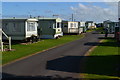
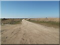
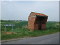
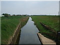
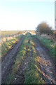
Living in Anderby Creek offers a compact, well-defined community within a 25.7-hectare built-up area. The area’s demographic profile suggests a mature population, with a median age of 70, reflecting a settled, long-term resident base. Daily life here is likely characterised by a quiet, established rhythm, with local amenities and services within practical reach. While the data does not specify the exact population, the high home ownership rate of 77% indicates a strong sense of local attachment. Anderby Creek’s small size means residents can navigate the area easily on foot or by bicycle, fostering a close-knit environment. The presence of five retail outlets, including Spar on Chapel Street and the Lincolnshire Co-operative, highlights the area’s practicality for everyday needs. For those considering a move, Anderby Creek balances simplicity with accessibility, though its limited size may appeal more to those seeking a low-maintenance lifestyle than a sprawling urban experience.
- Area Type
- Built Up Area 250
- Area Size
- 25.7 hectares
- Population
- Not available
- Population Density
- Not available
Residents of Anderby Creek have access to five retail outlets within practical reach, including Spar on Chapel Street and the Lincolnshire Co-operative on Station Road. These shops provide essentials like groceries and daily necessities, supporting a self-sufficient lifestyle. The area’s small size ensures these amenities are easily accessible, reducing the need for long commutes. While the data does not mention parks or leisure facilities, the presence of multiple retail options suggests a focus on convenience over expansive recreational spaces. For those prioritising ease of access to local services, Anderby Creek’s retail offerings contribute to a practical, low-effort daily routine. The character of the area is likely shaped by its compactness, where familiar faces and local businesses create a sense of continuity and community.
Amenities
Schools
| Rank | A + A* % | School | Type | Entry gender | Ages |
|---|
Explore more schools in this area
Go to Schools tabDemographics
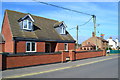
Anderby Creek’s population skews significantly towards older age groups, with a median age of 70. This suggests a community where many residents have lived for decades, contributing to a stable, familiar social fabric. The data does not specify household types or diversity metrics, but the 77% home ownership rate implies a majority of residents are long-term property owners rather than renters. This high rate of ownership may reflect a preference for fixed, low-maintenance housing, which aligns with the area’s compact size and older demographic. The absence of detailed information on accommodation types or ethnic diversity means the full picture of Anderby Creek’s community composition remains incomplete, but the figures provided underscore a population prioritising stability and permanence over transient living arrangements.
Household Size
Accommodation Type
Tenure
Ethnic Group
Religion
Household Composition
Age
Household Deprivation
NS-SEC
Explore more demographic insights in this area
Go to Demographics tabPlanning
Planning Constraints
- Crime RiskLocked