Area Overview for Ancaster
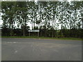
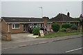
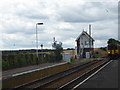
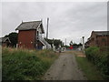
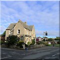
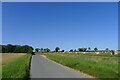
Photos of Ancaster


Area Information
Ancaster is a compact built-up area spanning 52.9 hectares in England, offering a quiet yet connected lifestyle. With a median age of 70, the community reflects a demographic skewed towards older residents, suggesting a mature, stable population. Daily life here is shaped by proximity to amenities such as three nearby railway stations—Ancaster, Rauceby, and Sleaford—along with retail outlets like Co-op Ancaster and Spar. The area’s small size fosters a sense of familiarity, though it remains well-served by digital connectivity, with a broadband score of 100, ensuring seamless online access. Ancaster’s charm lies in its balance of practicality and tranquillity, making it appealing to those seeking a low-maintenance, community-focused environment. The presence of Ancaster CofE Primary School, rated ‘good’ by Ofsted, adds to its appeal for families. While not a bustling urban hub, Ancaster provides a slice of rural England with the convenience of modern infrastructure.
- Area Type
- Built Up Area 250
- Area Size
- 52.9 hectares
- Population
- Not available
- Population Density
- Not available
Ancaster’s lifestyle is defined by its proximity to essential amenities. Local retail options include Co-op Ancaster, Spar, and Co-op Sleaford, offering everyday shopping convenience. The area’s small size means these shops are within practical reach, supporting a self-sufficient daily routine. For travel, the three nearby railway stations provide access to regional destinations, while the two nearby airports cater to those requiring air travel. Although the data does not mention parks or dining venues, the presence of retail and transport hubs suggests a functional, community-oriented lifestyle. Ancaster’s appeal lies in its balance of practicality and accessibility, ensuring residents can meet their needs without venturing far. The area’s character is one of quiet efficiency, with amenities serving both daily necessities and broader mobility needs.
Amenities
Schools
The nearest school to Ancaster is Ancaster CofE Primary School, a primary institution with an Ofsted rating of ‘good’. This school serves the local community, providing education for younger residents. While no secondary schools are listed in the data, the presence of a well-rated primary school is a significant draw for families. The school’s ‘good’ rating suggests it meets or exceeds national standards in teaching quality and student outcomes. However, families requiring secondary education may need to look beyond Ancaster, as no such institutions are detailed here. The single school listed reflects the area’s focus on primary education, which aligns with its older demographic profile. For those prioritising proximity to schools, Ancaster offers a reliable primary option but may require additional planning for secondary schooling.
| Rank | A + A* % | School | Type | Entry gender | Ages |
|---|---|---|---|---|---|
| 1 | N/A | Ancaster CofE Primary School | primary | N/A | N/A |
Explore more schools in this area
Go to Schools tabDemographics
Ancaster’s population is characterised by a median age of 70, indicating a community predominantly composed of older residents. This age profile suggests a settled, long-term population with a focus on stability rather than rapid growth. Home ownership is high, with 76% of households owning their properties, reflecting a preference for long-term residency. The accommodation types and household compositions are not specified in detail, but the overall data implies a mix of traditional housing stock. The area’s demographic profile, while lacking specific diversity metrics, aligns with a mature population that values established communities. This demographic structure may influence local services and amenities, which are tailored to the needs of older residents. The absence of detailed data on deprivation or diversity means the area’s social dynamics remain largely defined by its age and ownership statistics.
Household Size
Accommodation Type
Tenure
Ethnic Group
Religion
Household Composition
Age
Household Deprivation
NS-SEC
Explore more demographic insights in this area
Go to Demographics tabPlanning
Planning Constraints
- Crime RiskLocked