Area Overview for Alport & South West Parishes Ward
Photos of Alport & South West Parishes Ward
Area Information
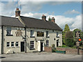
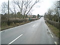
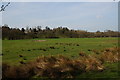
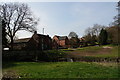
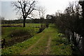
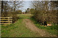
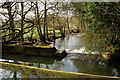
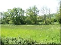
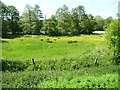
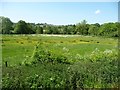
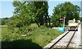
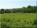
Living in Alport & South West Parishes Ward offers a distinctly rural experience within the Amber Valley district of Derbyshire. This electoral ward spans 99.2 square kilometres and sits near the coordinates 53.0158°N, -1.5422°W, placing it in the Derwent Valley close to Belper. The area encompasses specific parishes including Alport, Windley, Shottle & Postern, and stretches toward Alderwasley. You are buying into a region defined by open countryside rather than urban density, reflecting its location in the East Midlands. Daily life here revolves around the quiet rhythms of the Derbyshire non-metropolitan county structure. The ward stands apart from bustling city centres, offering a slower pace for those seeking a retreat from metropolitan living. Residents navigate a landscape that is largely residential and agricultural.
- Area Type
- District Borough Unitary Ward
- Area Size
- 99.2 km²
- Population
- Not available
- Population Density
- Not available
Demographics
The community of Alport & South West Parishes Ward is characterised by an exceptionally mature population. Your average neighbour here is 70 years old, making it one of the oldest wards in the country. This demographic profile means the local culture revolves around retirement and older lifestyle needs rather than families raising young children. You will find that 80% of the residents own their homes outright or with a mortgage, indicating a settled population with deep roots in the parish. This high ownership rate suggests low tenant turnover and a stable community where long-term residents know each other. The ward lacks significant ethnic diversity or religious sectarianism, presenting as a homogenous demographic profile typical of rural Derbyshire. With almost the entire population falling into broader age categories without specific age-range breakdowns, the social fabric is defined by this singular elderly population. Quality of life focuses on healthcare access and leisure suitable for seniors.
Household Size
Accommodation Type
Tenure
Ethnic Group
Religion
Household Composition
Age
Household Deprivation
NS-SEC
Explore more demographic insights in this area
Go to Demographics tabPlanning
Planning Constraints
- Flood RiskPremium
- Ramsar Wetland SitesPremium
- Area of Outstanding Natural BeautyPremium
- Protected Nature ReservePremium
- Protected WoodlandPremium
- Crime RiskPremium