Area Overview for Aby with Greenfield
Photos of Aby with Greenfield
Area Information
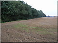
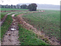
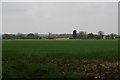
Aby with Greenfield stands as a distinct civil parish nestled within England, covering an area of 6.0 km². This small but defined territory offers residents a contained environment where local life operates on a specific rhythm. The area functions independently yet remains part of the wider county structure, providing a sense of place that is both manageable and rooted. Living in Aby with Greenfield means embracing a layout that prioritises the parish boundaries over sprawling urban development. You will find yourself in a setting where the physical landscape dictates daily movement rather than complex commuting networks. The compact size ensures that distances between key points remain short, fostering a community where proximity defines interaction. This is a place where the civil parish status matters, marking a clear administrative and geographical identity. Your daily life here will be shaped by these 6 square kilometres of land, offering a tangible sense of belonging. The area provides a stable backdrop for those seeking a location where the scope of your living space is clearly delineated from the outset.
- Area Type
- Parish
- Area Size
- 6.0 km²
- Population
- Not available
- Population Density
- Not available
Demographics
The community in Aby with Greenfield reflects a settled population with a median age of 70. This figure indicates that the residents are predominantly older adults who have established long-term roots in the parish. Age: Total serves as the baseline for understanding the demographic makeup, confirming that the area is not a hub for young families or transient workers. You will encounter neighbours who have likely lived here for decades, creating a tight-knit social fabric centred on mature life stages. The household composition data confirms that families and extended profiles dominate the social landscape rather than single-person households. Home ownership levels stand at an impressive 81%, suggesting that most residents are homeowners who have stayed put over many years. This high rate of ownership reinforces the stability of the demographic profile and points to a neighbourhood where inheritance and long-term residence are key factors. Accommodation types across the parish reflect this permanence, catering primarily to those who can afford such investments. With a predominance of older residents and a strong ownership culture, the social tone is one of continuity and established lifestyle choices rather than rapid demographic shifts.
Household Size
Accommodation Type
Tenure
Ethnic Group
Religion
Household Composition
Age
Household Deprivation
NS-SEC
Explore more demographic insights in this area
Go to Demographics tabPlanning
Planning Constraints
- Flood RiskPremium
- Ramsar Wetland SitesPremium
- Protected Nature ReservePremium
- Protected WoodlandPremium