Area Overview for Ab Kettleby
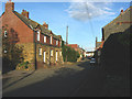
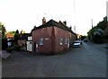
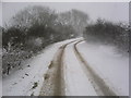
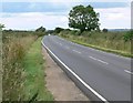
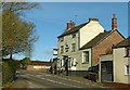
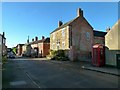
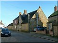
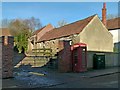
Photos of Ab Kettleby
Area Information
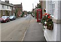
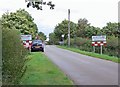
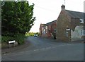
Living in Ab Kettleby means residing in a rural civil parish characterised by quiet streets and substantial green spaces. The parish covers an area of 12.7 square kilometres, providing ample room for residents to enjoy open landscapes away from the hustle of bustling urban centres. You will find this village to be a distinctly peaceful location where daily life revolves around the slower pace common to the English countryside. The community is centred on a strong sense of locality, with households situated across the parish enjoying proximity to natural features while remaining connected to wider networks. This area appeals to those seeking a traditional village experience where neighbours know one another and local amenities serve immediate daily needs. The physical setting offers a manageable size, ensuring that the community feels intimate rather than expanses of undeveloped land. Residents value this stability and the clear boundaries that define their neighbourhood. When considering homes in Ab Kettleby, you are investing in a location defined by its rural charm and consistent residential character. The lack of complex planning constraints further supports the idea of a stable environment for long-term living. You can expect a straightforward existence focused on the immediate surroundings rather than navigating distant infrastructure challenges.
- Area Type
- Parish
- Area Size
- 12.7 km²
- Population
- Not available
- Population Density
- Not available
Demographics
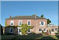
The community in Ab Kettleby is defined by a very mature population structure with a median age of 70 years. This demographic profile indicates that the village is primarily composed of older residents, many of whom are settled into their local homes. The age data suggests a population accustomed to area-based services and familiar local routines. With such a high median age, you will encounter a neighbourhood where intergenerational interaction revolves around the needs of retirement and established lifestyles. Home ownership stands at 78%, reflecting a deeply entrenched community where the majority of people have put down roots in Ab Kettleby. This high ownership rate points to residents who value stability and permanence within the parish. The household composition aligns with this profile, showing a community built around long-term settlement rather than transient populations. There is no indication of significant population turnover, which supports a stable social environment. You are looking at an area where families and individuals have chosen to stay for the long haul. The accommodation types mirror this trend, favouring properties suited to older occupants rather than high-density rental blocks. This makes Ab Kettleby a distinct choice for those prioritising low-turnover neighbourhoods.
Household Size
Accommodation Type
Tenure
Ethnic Group
Religion
Household Composition
Age
Household Deprivation
NS-SEC
Explore more demographic insights in this area
Go to Demographics tabPlanning
Planning Constraints
- Flood RiskPremium
- Ramsar Wetland SitesPremium
- Area of Outstanding Natural BeautyPremium
- Protected Nature ReservePremium
- Protected WoodlandPremium
- Crime RiskPremium