Building
Built 1930–1949.
Semi-Detached House
This is not a sales listing. Propbar data is compiled for informational purposes.
Walkability
39 / 100
Car-dependent
Transit
39 / 100
Limited transit
Closest essential
Co-op Perth
3 min walk
Closest transport
Perth Railway Station
15 min walk
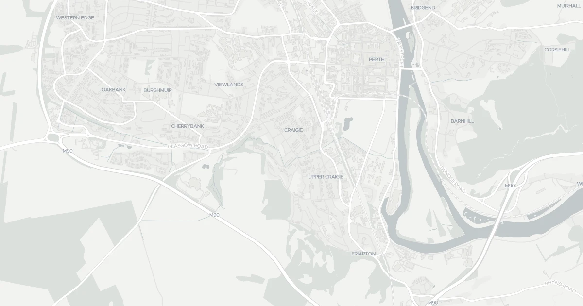
See nearby essentials and transport links overlaid on the property's location.
2 essentials within a 15-min walk. Closest nearby: 5 grocers.
Convenience store · Top-up shop, ethical & local sourcing · 0.23 km
Supermarket · Format varies by store — check before a big shop · 0.95 km
Discount supermarket · Budget weekly shop, limited range, low prices · 1.06 km
Discount supermarket · Budget weekly shop, limited range, low prices · 1.07 km
Supermarket · Full weekly shop, strong fresh & butcher counters · 1.11 km
1 rail station nearby. Check direct routes & frequency for your journeys.
Railway station · National Rail — check destinations & direct services · 0.68 km
1 airport nearby. For long-distance travel — check destinations & routes.
Airport · Flights & long-distance travel — check destinations · 7.37 km
Scores blend proximity and density of nearby essentials and transport links. Closer, with more options, scores higher.
This house is located at 54 Darnhall Drive in Perth (PH2 0HF). It offers around 67 m² of floor space. The property holds an EPC rating of C and dates from 1930–1949. Nearby shops include Co-op Perth, Tesco Perth, Aldi Craigie and Lidl Craigie, the closest about 229 m away. The nearest station is Perth Railway Station, around 684 m away.
Last Asking Price
—
Not currently listed
Propbar's Valuation Beta
£XXX
Range £XXX – £XXX
Price position
Price per sq ft
£XXX
Based on 721 ft²
Last Sold
—
No record
Market Timeline
—
Not currently listed
Times Listed
—
No history
Last Asking Rent
—
Not currently listed
Propbar's Valuation Beta
£XXX pcm
Range £XXX – £XXX pcm
Rent position
Gross Yield
X.X%
Annual return rate
Last Let
—
No record
Days on Market
—
Not currently listed
Times Listed
—
No history
1 of 12sections reviewed
Built 1930–1949.
We don't hold an HM Land Registry title on record for this address. This is common for leasehold flats, new builds and unregistered land.
No market history recorded for this property.
Sold prices, sales volumes and market pace for PH2 over the last 24 months.
Nothing on record for this property. See what's being applied for and built around it.
Outside the modelled flood-risk coverage (Scotland and Wales publish their own assessments).
What band C means for your bills, rental rules and upgrade headroom.
Crime data is only available for England and Wales, not Scotland.
This address sits inside a council-declared air quality zone. What that means for living here is below.
Prosperity data is not available for this property.
No school data is available for this property.
2 essentials within 15 min walk · 2 transport links nearby
We use cookies to provide you with the best experience. By continuing, you agree to our Cookie Policy .