Local Access
1 transport link nearby
Poor
This is not a sales listing. Propbar data is compiled for informational purposes.
Walkability
0 / 100
Car-only
Transit
32 / 100
Limited transit
Closest essential
East of England Co-operative Co
4 min drive
Closest transport
Diss Railway Station
9 min drive
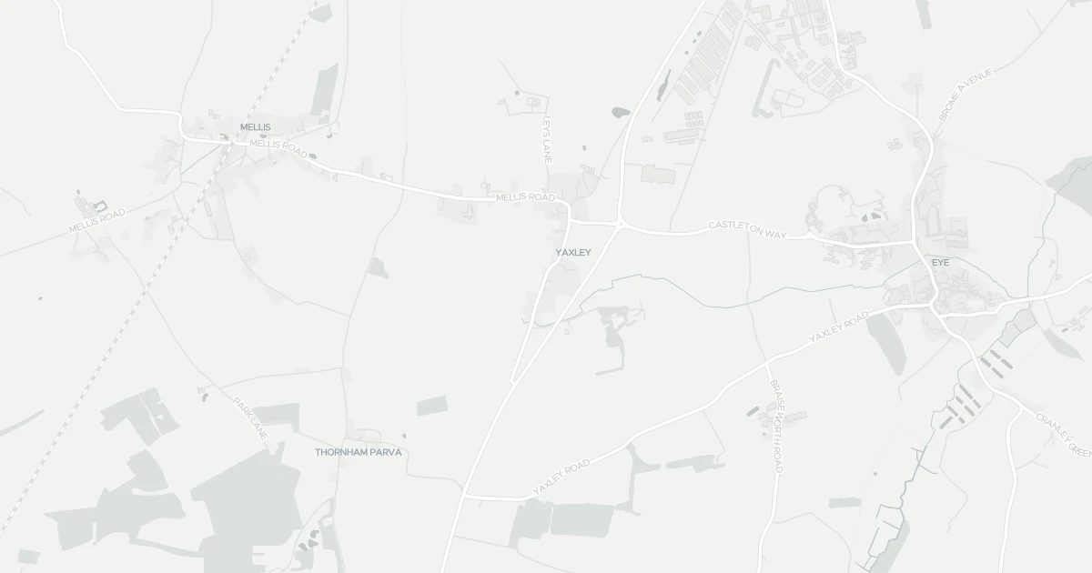
See nearby essentials and transport links overlaid on the property's location.
Nothing within a 15-min walk. Closest essentials are a short drive away.
Convenience store · Top-up shop, ethical & local sourcing · 2.49 km
Convenience store · Top-up shop, ethical & local sourcing · 2.62 km
Independent grocer · Local independent, top-up shop & specialty items · 5.20 km
Supermarket · Format varies by store — check before a big shop · 5.65 km
Supermarket · Full weekly shop, strong fresh & butcher counters · 5.72 km
1 rail station nearby. Check direct routes & frequency for your journeys.
Railway station · National Rail — check destinations & direct services · 5.91 km
Scores blend proximity and density of nearby essentials and transport links. Closer, with more options, scores higher.
A four-bedroom detached house at Wheatfields in Suffolk (IP23 8EJ). It offers two bathrooms and around 152 m² of floor space. The property holds an EPC rating of D and dates from 1996–2002. Land Registry records a sale at £131,000 in August 1998. Nearby shops include East of England Co-operative Co, Co-op Eye, M&S Scole BP and Tesco Diss, the closest about 2.5 km away. The nearest station is Diss Railway Station, around 5.9 km away. Broadband and mobile coverage in the area are both strong. The Environment Agency records no modelled flood risk at this address.
Last Asking Price
£525,000
Last on market 4 years ago
Propbar's Valuation Beta
£XXX
Range £XXX – £XXX
Price position
Price per sq ft
£XXX
Based on 1,636 ft²
Last Sold
£530,000
Sold January 2023
Market Timeline
—
Not currently listed
Times Listed
1 listing
First listing
Last Asking Rent
—
Not currently listed
Propbar's Valuation Beta
£XXX pcm
Range £XXX – £XXX pcm
Rent position
Gross Yield
X.X%
Annual return rate
Last Let
—
No record
Days on Market
—
Not currently listed
Times Listed
—
No history
1 of 12sections reviewed
1 transport link nearby
Built 1996–2002.
Freehold confirmed by HM Land Registry. Unlock to reveal owner, charges and restrictions.
Listing history, price moves and time on market for this address.
Sold prices, sales volumes and market pace for IP23 over the last 24 months.
Nothing on record for this property. See what's being applied for and built around it.
Assessed: no modelled flood risk at this address.
What band D means for your bills, rental rules and upgrade headroom.
Safety score for IP23 8EJ, the recent trend and offence-by-offence breakdown.
Pollutant levels, the official index and health context for this address.
Where IP23 8EJ sits on the national prosperity ladder, and what drives it.
Admission chances, ratings and catchment status for 7 schools nearby.
We use cookies to provide you with the best experience. By continuing, you agree to our Cookie Policy .