Building
Building details available below.
Detached
This is not a sales listing. Propbar data is compiled for informational purposes.
Rivers & sea
Low
Knee deep — wading difficult
Surface water
Not modelled
No surface-water risk modelled here
Climate 2080
Rising
Medium projected for 2080
Flood defences
71 nearby
Nearest 135m away
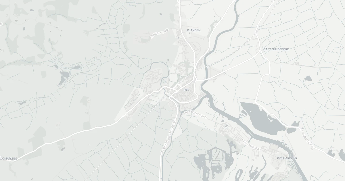
Use the interactive map to see how flood layers sit relative to the property.
Both modelled flood sources for this property are low or very low. No action expected.
About a 1-in-1,000 chance each year. Modelled depth up to 0.3m — knee deep — wading difficult.
No modelled surface-water (heavy-rain) flood risk at this address.
This property sits in Flood Zone 1 — the lowest-probability planning zone. No flood-specific planning checks normally apply.
The lowest-probability planning flood zone — under a 0.1% river / 0.5% sea chance each year. A full FRA is usually only needed for large sites or where the council flags a local concern.
Flood defences sit nearby. They reduce but never remove flood risk, and may not protect this specific property.
Flood defences sit nearby. They reduce but never remove flood risk, and may not protect this specific property.
On River Tillingham, maintained by Environment Agency, good condition.
Flood risk here is projected to rise to medium by 2080 under current climate models.
Flood risk here is projected to rise to medium by the 2080s under current climate models.
At this flood-risk level, standard home insurance typically covers flooding without difficulty.
At this flood-risk level, standard home insurance typically covers flooding without difficulty.
A government-backed scheme that helps keep flood insurance affordable for eligible homes built before 2009.
General guidance based on the modelled flood-risk level — not an insurance quote or advice.
Source: Environment Agency · National Flood Risk Assessment (NaFRA 2), via Vepler Flood . Check on GOV.UK
A detached house at 19 CYPRUS PLACE, TN31 7DR. It offers around 57 m² of floor space. The property holds an EPC rating of D. Land Registry records a sale at £59,000 in October 1996. Nearby shops include Co-op Winchelsea, the closest about 3.9 km away. The nearest stations are Rye Railway Station, Winchelsea Railway Station and Doleham Railway Station, around 177 m away. The Environment Agency rates this address at low risk of flooding.
Last Asking Price
—
Not currently listed
Propbar's Valuation Beta
£XXX
Range £XXX – £XXX
Price position
Price per sq ft
£XXX
Based on 614 ft²
Last Sold
£297,000
Sold June 2021
Market Timeline
—
Not currently listed
Times Listed
—
No history
Last Asking Rent
—
Not currently listed
Propbar's Valuation Beta
£XXX pcm
Range £XXX – £XXX pcm
Rent position
Gross Yield
X.X%
Annual return rate
Last Let
—
No record
Days on Market
—
Not currently listed
Times Listed
—
No history
1 of 12sections reviewed
Building details available below.
Freehold confirmed by HM Land Registry. Unlock to reveal owner, charges and restrictions.
Listing history, price moves and time on market for this address.
Sold prices, sales volumes and market pace for TN31 over the last 24 months.
Nothing on record for this property. See what's being applied for and built around it.
Rivers & sea, surface water and the 2080 climate outlook for this address.
What band D means for your bills, rental rules and upgrade headroom.
Safety score for TN31 7DR, the recent trend and offence-by-offence breakdown.
Pollutant levels, the official index and health context for this address.
Where TN31 7DR sits on the national prosperity ladder, and what drives it.
Admission chances, ratings and catchment status for 5 schools nearby.
5 transport links nearby
We use cookies to provide you with the best experience. By continuing, you agree to our Cookie Policy .