Local Access
1 essential within 15 min walk · 7 transport links nearby
Poor
This is not a sales listing. Propbar data is compiled for informational purposes.
Rivers & sea
Very Low
Above head height — life-threatening
Surface water
Not modelled
No surface-water risk modelled here
Climate 2080
Rising
High projected for 2080
Flood defences
16 nearby
Nearest 23m away
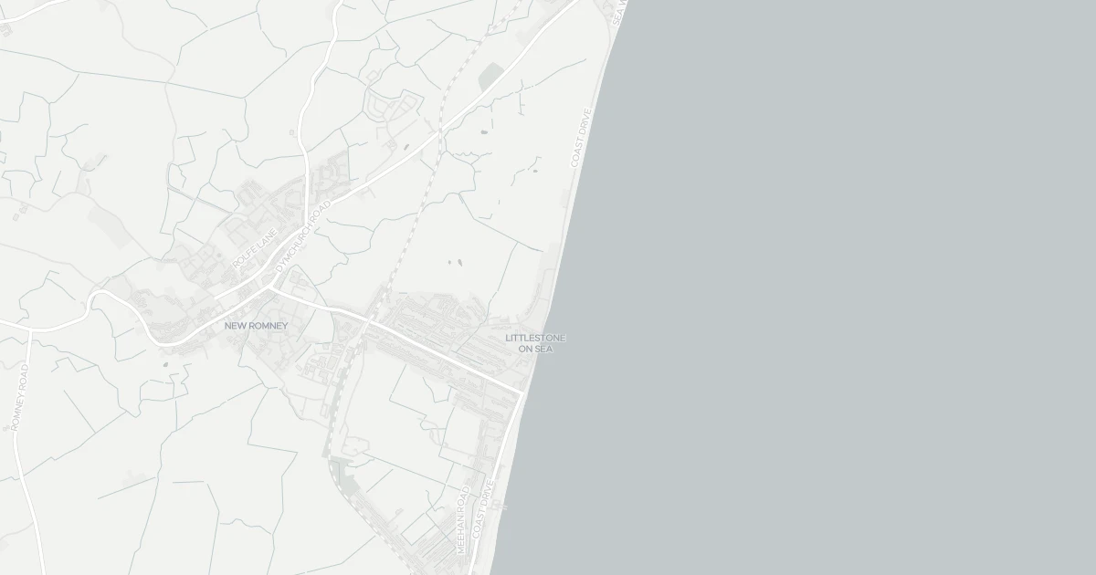
Use the interactive map to see how flood layers sit relative to the property.
Both modelled flood sources for this property are low or very low. No action expected.
About a 1-in-10,000 chance each year. Modelled depth up to 1.2m — above head height — life-threatening.
No modelled surface-water (heavy-rain) flood risk at this address.
This property sits in Flood Zone 3 — the highest-probability planning zone. Developing or extending here normally needs a Flood Risk Assessment and must pass the planning sequential test.
A high-probability planning zone. FRA and sequential test required, and an exception test may apply for more-vulnerable uses.
Flood defences sit nearby. They reduce but never remove flood risk, and may not protect this specific property.
Flood defences sit nearby. They reduce but never remove flood risk, and may not protect this specific property.
On Nashe's Run, maintained by Environment Agency, good condition.
Flood risk here is projected to rise to high by 2080 under current climate models.
Flood risk here is projected to rise to high by the 2080s under current climate models.
At this flood-risk level, standard home insurance typically covers flooding without difficulty.
At this flood-risk level, standard home insurance typically covers flooding without difficulty.
A government-backed scheme that helps keep flood insurance affordable for eligible homes built before 2009.
General guidance based on the modelled flood-risk level — not an insurance quote or advice.
Source: Environment Agency · National Flood Risk Assessment (NaFRA 2), via Vepler Flood . Check on GOV.UK
A seven-bedroom detached house at Romney Hard, TN28 8QZ. It is currently for sale. It offers four bathrooms and around 455 m² of floor space. The property holds an EPC rating of D and dates from 1900–1929. Nearby shops include Co-op New, Spar, Sainsburys New and Tesco Dymchurch, the closest about 1.1 km away. The nearest stations are New Romney Station, Romney Warren Halt and St Mary's Bay Station, around 1.2 km away. The Environment Agency rates this address at very low risk of flooding.
Asking Price
£900,000
Listed 1 year ago
Propbar's Valuation Beta
£XXX
Range £XXX – £XXX
Price position
Price per sq ft
£XXX
Based on 4,898 ft²
Last Sold
—
No record
Market Timeline
419 days
Long time on market
Times Listed
1 listing
First listing
Last Asking Rent
—
Not currently listed
Propbar's Valuation Beta
£XXX pcm
Range £XXX – £XXX pcm
Rent position
Gross Yield
X.X%
Annual return rate
Last Let
—
No record
Days on Market
—
Not currently listed
Times Listed
—
No history
1 of 12sections reviewed
1 essential within 15 min walk · 7 transport links nearby
Built 1900–1929.
Freehold confirmed by HM Land Registry. Unlock to reveal owner, charges and restrictions.
Listing history, price moves and time on market for this address.
Sold prices, sales volumes and market pace for TN28 over the last 24 months.
Nothing on record for this property. See what's being applied for and built around it.
Rivers & sea, surface water and the 2080 climate outlook for this address.
What band D means for your bills, rental rules and upgrade headroom.
Safety score for TN28 8QZ, the recent trend and offence-by-offence breakdown.
Pollutant levels, the official index and health context for this address.
Where TN28 8QZ sits on the national prosperity ladder, and what drives it.
Admission chances, ratings and catchment status for 5 schools nearby.
We use cookies to provide you with the best experience. By continuing, you agree to our Cookie Policy .