Crime & Safety
Crime in NE33 1SJ is well above the national average. Safety score 0 out of 100, where higher is safer. Check the breakdown below.
Very high crime
This is not a sales listing. Propbar data is compiled for informational purposes.
Walkability
49 / 100
Somewhat walkable
Transit
51 / 100
Some transit
Closest essential
Asda South
4 min walk
Closest transport
South Shields
8 min walk
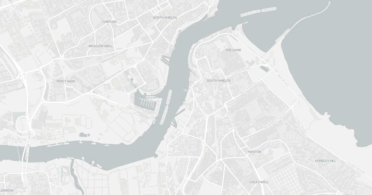
See nearby essentials and transport links overlaid on the property's location.
5 essentials within a 15-min walk. Closest nearby: 5 grocers.
Supermarket · Big weekly shop, low prices, larger formats common · 0.25 km
Independent grocer · Local independent, top-up shop & specialty items · 0.28 km
Supermarket · Full weekly shop, strong fresh & butcher counters · 0.74 km
Discount supermarket · Budget weekly shop, limited range, low prices · 0.78 km
Independent grocer · Local independent, top-up shop & specialty items · 0.79 km
5 rail stations · 5 metro stops · 1 bus stop nearby. Check direct routes & frequency for your journeys.
Railway station · National Rail — check destinations & direct services · 4.27 km
Railway station · National Rail — check destinations & direct services · 5.66 km
Railway station · National Rail — check destinations & direct services · 6.54 km
Railway station · National Rail — check destinations & direct services · 8.19 km
Railway station · National Rail — check destinations & direct services · 8.85 km
Metro / Underground · Frequent urban transit, short-hop city travel · 0.56 km
Metro / Underground · Frequent urban transit, short-hop city travel · 1.08 km
Metro / Underground · Frequent urban transit, short-hop city travel · 1.22 km
Metro / Underground · Frequent urban transit, short-hop city travel · 1.69 km
Metro / Underground · Frequent urban transit, short-hop city travel · 2.17 km
Bus stop · Local bus services, check routes & frequency · 7.04 km
2 ferry terminals nearby. For long-distance travel — check destinations & routes.
Ferry terminal · Ferry services — check routes & destinations · 0.15 km
Ferry terminal · Ferry services — check routes & destinations · 0.69 km
Scores blend proximity and density of nearby essentials and transport links. Closer, with more options, scores higher.
This commercial is located at Harton Low Staithes, NE33 1SJ. Nearby shops include Asda South, Heron Market, Morrisons South and Lidl Central South, the closest about 252 m away. The nearest stations are South Shields, North Shields and Chichester, around 560 m away.
Last Asking Price
—
Not currently listed
Propbar's Valuation Beta
£XXX
Range £XXX – £XXX
Price position
Price per sq ft
£XXX
Floor area required
Last Sold
—
No record
Market Timeline
—
Not currently listed
Times Listed
—
No history
Last Asking Rent
—
Not currently listed
Propbar's Valuation Beta
£XXX pcm
Range £XXX – £XXX pcm
Rent position
Gross Yield
X.X%
Annual return rate
Last Let
—
No record
Days on Market
—
Not currently listed
Times Listed
—
No history
1 of 12sections reviewed
Crime in NE33 1SJ is well above the national average. Safety score 0 out of 100, where higher is safer. Check the breakdown below.
Building details available below.
We don't hold an HM Land Registry title on record for this address. This is common for leasehold flats, new builds and unregistered land.
No market history recorded for this property.
Sold prices, sales volumes and market pace for NE33 over the last 24 months.
Nothing on record for this property. See what's being applied for and built around it.
This address has not been assessed for flood risk.
No Energy Performance Certificate data is on file for this property.
Pollutant levels, the official index and health context for this address.
Where NE33 1SJ sits on the national prosperity ladder, and what drives it.
Admission chances, ratings and catchment status for 40 schools nearby.
5 essentials within 15 min walk · 13 transport links nearby
We use cookies to provide you with the best experience. By continuing, you agree to our Cookie Policy .