Area Overview for Sheffield
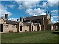
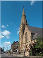
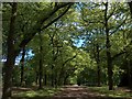
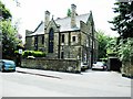
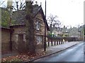
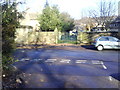
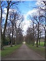
Photos of Sheffield

Area Information
Sheffield, a built-up area in England covering 114.1 km², is home to 259,695 residents, making it a densely populated urban space with 2,276 people per square kilometre. This city is defined by its industrial heritage, green spaces, and proximity to the Peak District. Daily life here balances urban convenience with access to nature, with residents navigating a mix of historic architecture and modern developments. The area’s compact size means amenities and services are within easy reach, while its transport links, including multiple railway stations, connect it to surrounding regions. Sheffield’s character is shaped by its working-class roots, reflected in its community dynamics and affordable housing options. For homebuyers, the city offers a blend of practicality and opportunity, though its population density means space is at a premium. Whether you’re drawn to its cultural offerings or its proximity to outdoor recreation, Sheffield presents a distinct lifestyle that prioritises accessibility over sprawl.
- Area Type
- Built Up Area 250
- Area Size
- 114.1 km²
- Population
- 259695
- Population Density
- 2276 people/km²
Residents of Sheffield have access to a range of amenities within walking or short travel distance. Retail options include major chains like M&S and Tesco, as well as local shops such as Spar, providing everyday essentials. The metro system, with stops at Granville Rd and Park Grange Croft, offers quick access to urban hubs. Railway stations like Sheffield Stn and Meadowhall connect to broader networks, facilitating travel to nearby cities. Parks and open spaces, though not named in the data, are likely accessible given the city’s green character. This mix of retail, transport, and connectivity creates a convenient lifestyle, balancing urban living with practicality. The presence of multiple railway stations and metro points also suggests a dynamic, interconnected community.
Amenities
Schools
Sheffield’s proximity to several schools includes Aston Fence Junior and Infant School, which holds an outstanding Ofsted rating, and four nursery schools: Broomhall, Denby Street, Grace Owen, and Birley Nursery Schools. This mix of primary and nursery education options caters to families with young children, providing early years care and foundational schooling. The presence of an outstanding-rated primary school suggests high standards in at least one key institution, though the overall quality of local schools would depend on specific neighbourhoods. For parents, the availability of multiple nurseries indicates accessibility to early education, which is crucial for working families. However, the data does not provide Ofsted ratings for the nursery schools, so their performance remains unquantified.
| Rank | School | Type | Entry gender | Ages |
|---|
Explore more schools in this area
Go to Schools tabDemographics
Sheffield’s population has a median age of 70, indicating a community skewed towards older adults. This demographic profile suggests a mature population, which may influence local services and housing demand. Home ownership stands at 58%, reflecting a mix of owner-occupied and rental properties. The accommodation types and household compositions are not specified in detail, but the data highlights a total figure for both categories, implying diversity in living arrangements. The area’s predominant ethnic group and religious composition are not quantified, though the absence of specific data means these aspects remain unexplored in this analysis. The high median age may correlate with a lower proportion of young families, which could impact local schools and childcare facilities. For buyers, understanding this demographic context is key to assessing long-term property value trends and community needs.