Area Overview for Frampton Cotterell
Photos of Frampton Cotterell

Area Information
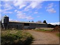
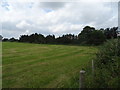
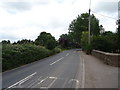
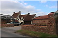
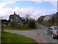
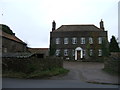
Frampton Cotterell is a civil parish located in South Gloucestershire, South West England. This settlement sits on the River Frome and covers a total area of 8.5 square kilometres. The population stands at 1,668 residents, creating a quiet, rural community atmosphere. Historical records indicate this place was first mentioned as Frantone in the Domesday Book of 1086. You will find the village defined on the ridge between Lower Stone Close and the river. Nearby hamlets include Winterbourne and Coalpit Heath, forming a broader local area. The landscape features common lands such as Frampton Common, Adam's Land, Brockridge, and Woodend Green. St Peter's Church occupies a historic site recorded as early as 1086. A 19th-century hat factory once operated on Park Lane, and a watermill stood near the B4058 bridge at Cogmill. While the watermill was demolished, its tail-race tunnel remains. Edwin Fowler, a local WWII hero, responded to the first bomb drop during the war. Living here offers proximity to nature and a connection to deep history without urban congestion. The settlement name derives from Old English, meaning a settlement on the Frome.
- Area Type
- Parish
- Area Size
- 8.5 km²
- Population
- 1668
- Population Density
- 197 people/km²
Demographics
The community in Frampton Cotterell displays a distinct age profile with a median age of 70. This figure indicates a population dominated by older residents compared to national averages. You will find the most common age range falls under the 'Age: Total' category, reflecting this older demographic skew. Home ownership is prevalent, with 82% of households owning their property. This high percentage suggests a stable, long-term resident base rather than a transient population. Census data for household composition and accommodation types is available for the total area, though specific breakdowns are not detailed in the provided records. The area does not specify a predominant ethnic group in the current data. Religious affiliation figures are also recorded for the total population but lack specific denominational splits. Despite the aging population, the area maintains a cohesive community structure. The high ownership rate often correlates with reduced household turnover. This demographic makeup means you are likely to experience a neighbourhood accustomed to slower paces of life. The 82% ownership statistic highlights that moving to these homes usually involves purchasing an existing property.
Household Size
Accommodation Type
Tenure
Ethnic Group
Religion
Household Composition
Age
Household Deprivation
NS-SEC
Explore more demographic insights in this area
Go to Demographics tabPlanning
Planning Constraints
- Flood RiskPremium
- Ramsar Wetland SitesPremium
- Area of Outstanding Natural BeautyPremium
- Protected Nature ReservePremium
- Protected WoodlandPremium