Area Overview for Charnock Richard
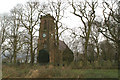
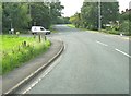
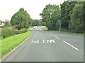
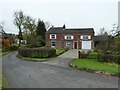
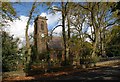
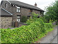
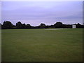
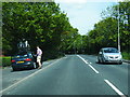
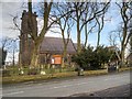
Photos of Charnock Richard
Area Information
Charnock Richard is a built-up area located in Lancashire, covering a total of 78.7 hectares. It functions as a distinct residential settlement rather than a large city. The location serves as a practical base for residents seeking stability. You will find a community where life moves at a deliberate pace, anchored by strong local roots. The neighbourhood is compact enough to maintain a sense of familiarity yet structured enough to offer essential services nearby. Living in Charnock Richard means relying on close-knit connections and established infrastructure. The area provides a grounded environment for those who prefer predictability over rapid urban change. You gain immediate access to major retail chains and railway links without the noise of a larger metropolis. This balance creates a setting where daily routines remain manageable. The physical footprint supports a concentration of homes that form a cohesive village-like atmosphere. Your experience here will be defined by these clear boundaries and specific local character.
- Area Type
- Built Up Area 250
- Area Size
- 78.7 hectares
- Population
- Not available
- Population Density
- Not available
Residents of Charnock Richard benefit from five retail venues located just outside their immediate boundaries. You can shop at Waitrose and the local Spar branch within easy walking or driving distance. The Co-op in Coppull is another staple shop available to you. These five outlets form the core of your local high street experience. Dining options are integrated with these retail stores for convenience. You will find five railway stations nearby, including Euxton Balshaw Lane Railway Station, Chorley Railway Station, and Buckshaw Parkway Railway Station. These transport hubs are essential for connecting Charnock Richard to the wider region. The combination of supermarkets and mainline stations creates a functional lifestyle. You do not need to travel far for groceries or regional connections. Daily life revolves around these key named locations. The amenities provide a self-contained loop for your weekly schedule.
Amenities
Schools
The primary educational facility for children living near Charnock Richard is Christ Church Charnock Richard CofE Primary School. This institution holds an Ofsted rating of good. It serves as the main local school for families in the immediate vicinity. The school type is community-based with a religious designation. This single listed option indicates a constrained provision for primary education within the immediate catchment area. You must consider travel distances for any other schooling needs as this is the only nearby school with a public rating. Families rely on this specific institution for their early education requirements. The mix of school types is currently limited to this one primary provider. Prospective buyers should research surrounding suburbs for secondary options as no other local schools appear in the available records. This school represents the core educational resource for the neighbourhood.
| Rank | A + A* % | School | Type | Entry gender | Ages |
|---|---|---|---|---|---|
| 1 | N/A | Christ Church Charnock Richard CofE Primary School | primary | N/A | N/A |
Explore more schools in this area
Go to Schools tabDemographics
The community in Charnock Richard reflects a very settled population with a median age of 70 years. This figure indicates that the majority of residents are older inhabitants. The most common age range spans the total population, highlighting an older snapshot of the local counts. Ownership of property within the area stands at 86 per cent. This high percentage demonstrates that residents have purchased their current homes rather than renting. Most households consist of owners who have likely upgraded their properties as they aged. You will find that many families have down-sized or lived here for decades. The accommodation types support this long-term ownership trend. The demographic profile suggests a quiet environment where neighbours have known each other for years. This stability provides a predictable social fabric for anyone moving into homes in Charnock Richard. You are stepping into an established community where tenure is the norm.
Household Size
Accommodation Type
Tenure
Ethnic Group
Religion
Household Composition
Age
Household Deprivation
NS-SEC
Explore more demographic insights in this area
Go to Demographics tabPlanning
Planning Constraints
- Crime RiskLocked