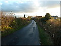
Area Overview for Ashton Hurst Ward
Photos of Ashton Hurst Ward

Area Information
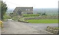
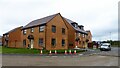
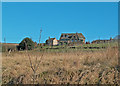
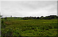
Nestled within Tameside, Ashton Hurst Ward presents a compact residential district covering just 4.9 square kilometres. This small electoral constituency forms part of the larger Ashton-under-Lyne Borough Constituency, represented nationally by Labour MP Angela Rayner. Locally, governance is shared between three councillors: Dan Costello from the Conservative party, alongside Mike Glover and Mohammed Karim, both Labour. The area is small enough to feel intimate yet situated within the metropolitan borough of Tameside in North West England. You will find 1,574 residents calling this ward home, creating a population density of 324 people per square kilometre. This specific geographic footprint combines electoral politics with daily living for a defined community group. The ward sits at coordinates 53.5080°N, 2.0749°W, anchoring its location firmly in the region. Living in Ashton Hurst Ward means navigating a specific local council area with distinct political representation while enjoying the broader context of the north of England. The land use and boundaries are officially mapped, ensuring clear understanding of your locale. You are aware of the exact size and administrative boundaries before you even look at a specific address. This knowledge provides a solid foundation for anyone considering moving to this ward or planning local investments.
- Area Type
- District Borough Unitary Ward
- Area Size
- 4.9 km²
- Population
- 1574
- Population Density
- 324 people/km²
Demographics
The community profile of Ashton Hurst Ward skews significantly towards older residents, with a median age of 70 years. This demographic reality shapes the daily rhythm of the ward and influences local service requirements. The most common age range recorded is simply listed as 'Total', indicating a broad spread, though the central tendency points firmly to senior living. Home ownership stands at a commanding 63%, suggesting a strong sense of settled tenure among the population. This high rate of ownership often correlates with the older age profile, as younger buyers may struggle to enter the market or choose rental alternatives. Household composition and accommodation type statistics classify the population broadly under total categories, reflecting a stable residential mix. While specific ethnic group and religious demographic splits are not detailed in the available records, the area remains a defined ward within the Ashton-under-Lyne constituency. The absence of a young workforce demographic may affect local retail demand and community activities. You should note that a predominantly older population often means quieter streets and distinct social dynamics. Quality of life here is heavily influenced by services catering to senior needs, from healthcare access to leisure facilities suitable for this age group. The 63% ownership figure is a concrete fact that defines the financial backdrop for anyone entering the local market.
Household Size
Accommodation Type
Tenure
Ethnic Group
Religion
Household Composition
Age
Household Deprivation
NS-SEC
Explore more demographic insights in this area
Go to Demographics tabPlanning
Planning Constraints
- Flood RiskPremium
- Ramsar Wetland SitesPremium
- Area of Outstanding Natural BeautyPremium
- Protected Nature ReservePremium
- Protected WoodlandPremium