Area Overview for E15 4UE
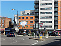
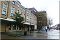
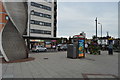
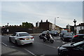
Photos of E15 4UE
Area Information
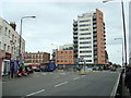
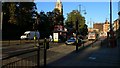
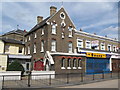
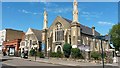
E15 4UE is a small residential postcode in East London’s Forest Gate South ward, part of the London Borough of Newham. The area is defined by its Victorian terraced houses, brick-built buildings, and compact layout, blending historic architecture with modern convenience. With a population recorded in 2021, it reflects a community rooted in the 19th-century development of the Forest Gate district, once a boundary between Epping Forest and Romford Road. The area’s character is shaped by its proximity to main roads like Woodford Road and its mix of residential streets, small parks, and commercial strips. Residents benefit from nearby transport hubs, including rail and DLR stations, and a range of retail outlets such as Sainsburys and Morrisons. The postcode’s compact size means daily life revolves around its immediate surroundings, with a focus on local amenities and easy access to broader London networks. Its history as part of the former West Ham borough adds a layer of heritage, while its current layout caters to a practical, urban lifestyle.
- Area Type
- Postcode
- Area Size
- Not available
- Population
- 2021
- Population Density
- 19414 people/km²
E15 4UE is predominantly a rental market, with only 20% of homes owned by residents. The accommodation type is almost exclusively flats, reflecting the area’s compact, urban layout. This suggests a focus on smaller, manageable properties suited to families or individuals seeking convenience over space. The low home ownership rate may indicate limited opportunities for buyers to purchase property, with the market likely dominated by landlords or investment firms. The concentration of flats also means the area lacks larger homes or detached properties, which could be a consideration for those prioritising space. For buyers, the small postcode area and surrounding districts may offer limited options, requiring a broader search beyond E15 4UE. However, the presence of historic features like the Woodgrange Estate and conservation areas adds a layer of architectural appeal that could attract buyers interested in heritage properties.
House Prices in E15 4UE
No properties found in this postcode.
Energy Efficiency in E15 4UE
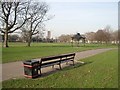
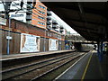
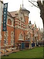
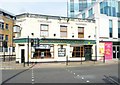
Living in E15 4UE offers access to a range of amenities within practical reach. The area is served by five major retail outlets, including Sainsburys Stratford, Tesco Stratford, and Morrisons Stratford, ensuring daily shopping needs are met. Transport options are extensive, with rail, metro, and bus services connecting residents to nearby hubs like Whipps Cross Bus Interchange and Stratford High Street. Parks such as Plashet Park provide green space for leisure, while the historic Woodgrange Estate and its clock offer a touch of local heritage. The area’s proximity to the River Thames and ferry piers adds to its appeal for those seeking waterfront activities. The mix of retail, transport, and recreational facilities creates a convenient, dynamic lifestyle, balancing urban convenience with access to nature and cultural landmarks.
Amenities
Schools
| Rank | School | Type | Entry gender | Ages |
|---|
Explore more schools in this area
Go to Schools tabDemographics
The population of E15 4UE has a median age of 47, with the majority of residents aged between 30 and 64. This suggests a mature, stable community, likely with established careers and families. Home ownership is relatively low at 20%, indicating that most households are renters, possibly due to the area’s focus on flats as the predominant accommodation type. The Asian community forms the largest ethnic group, contributing to the area’s cultural diversity. This demographic profile implies a mix of long-term residents and those drawn to the area’s affordability and transport links. The 20% home ownership rate also suggests limited availability of owner-occupied properties, which may influence the local property market’s dynamics. The presence of a significant Asian population adds to the area’s distinct identity, though specific data on other ethnic groups is not provided.
Household Size
Accommodation Type
Tenure
Ethnic Group
Religion
Household Composition
Age
Household Deprivation
NS-SEC
Explore more demographic insights in this area
Go to Demographics tabPlanning
Planning Constraints
- Flood RiskPremium
- Ramsar Wetland SitesPremium
- Area of Outstanding Natural BeautyPremium
- Protected Nature ReservePremium
- Protected WoodlandPremium