Area Overview for E12 9AL
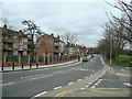
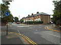
Photos of E12 9AL


Area Information
Living in E12 9AL means being part of a small, tightly knit residential cluster in England’s east. With a population of just 1,607, the area feels quiet and unassuming, yet it is well-connected to nearby towns and cities. The community is largely composed of adults aged 30–64, reflecting a mature demographic that shapes the area’s character. Daily life here is defined by proximity to transport hubs and retail amenities, with five rail stations and multiple metro stops within reach. While the area is not expansive, its strategic location offers easy access to London City Airport and ferry services, making it appealing for commuters. The low flood risk and absence of environmental restrictions suggest a stable living environment, though the medium crime risk means residents should take standard precautions. E12 9AL is not a place for those seeking luxury or sprawling landscapes, but it offers practical living for those prioritising connectivity and affordability.
- Area Type
- Postcode
- Area Size
- Not available
- Population
- Not available
- Population Density
- Not available
The property market in E12 9AL is characterised by a high proportion of rental properties, with only 24% of homes owned by residents. This suggests a transient population and limited opportunities for long-term investment in private ownership. The accommodation type is exclusively flats, which are typically managed by private landlords or housing associations. This configuration may appeal to renters seeking low-maintenance living, but it also limits options for buyers seeking larger or detached properties. The small area’s immediate surroundings likely offer similar housing stock, reinforcing the dominance of flats in the local market. For buyers, this means competition for limited owner-occupied listings and a focus on rental yields for investors. The lack of data on property prices or recent sales trends means the market’s affordability remains unclear, though the low home ownership rate implies a strong rental demand.
House Prices in E12 9AL
No properties found in this postcode.
Energy Efficiency in E12 9AL
Residents of E12 9AL have access to a range of amenities within practical reach. Retail options include major supermarkets like Tesco Forestgate and Tesco Romford, providing everyday shopping convenience. The area’s rail and metro stations, such as East Ham and Redbridge, connect to cultural and commercial hubs in London. Five ferry piers, including North Greenwich Pier, offer waterfront leisure opportunities. While the area lacks large parks or entertainment venues, its proximity to transport links means residents can easily access green spaces and events in nearby towns. The presence of multiple retail and transport nodes suggests a practical, commuter-focused lifestyle, where convenience and accessibility outweigh the need for on-site amenities. Daily life here is shaped by the rhythm of public transport and the availability of essential services.
Amenities
Schools
| Rank | School | Type | Entry gender | Ages |
|---|
Explore more schools in this area
Go to Schools tabDemographics
E12 9AL’s population of 1,607 is predominantly adults aged 30–64, with a median age of 47. This suggests a community of established professionals and families, rather than students or retirees. Home ownership is low, with just 24% of residents owning their homes, indicating a rental-heavy market. The accommodation type is almost entirely flats, reflecting a preference for smaller, managed housing units. The area’s predominant ethnic group is Asian, which influences local culture and community dynamics. While no specific deprivation data is provided, the combination of low home ownership and a mature age profile may suggest a mix of long-term residents and those in transitional housing phases. The absence of detailed diversity metrics means the full extent of cultural variety remains unquantified, but the presence of Asian communities is a clear feature.
Household Size
Accommodation Type
Tenure
Ethnic Group
Religion
Household Composition
Age
Household Deprivation
NS-SEC
Explore more demographic insights in this area
Go to Demographics tabPlanning
Planning Constraints
- Flood RiskPremium
- Ramsar Wetland SitesPremium
- Area of Outstanding Natural BeautyPremium
- Protected Nature ReservePremium
- Protected WoodlandPremium