Area Overview for CO1 2SR
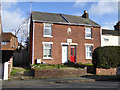
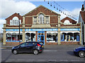
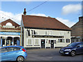
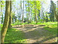
Photos of CO1 2SR
Area Information
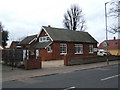
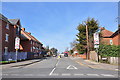
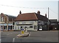
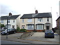
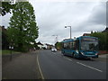
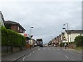
CO1 2SR is a small residential postcode area in Colchester, Essex, home to 1,364 people. Situated in the eastern suburbs, it forms part of Greenstead Ward, historically known as Greenstead-juxta-Colchester. The area blends modest housing with pockets of historical interest, such as Gallow Green and St. Edmund’s church hall. Daily life here is shaped by its proximity to Colchester’s urban core, with easy access to rail networks and local amenities. The community is defined by its mature demographic, with a median age of 47 and a majority of residents aged 30–64. While the area is compact, it offers a quiet residential character, with houses dominating the housing stock. Its small size means residents are likely to know their neighbours, though the lack of large-scale infrastructure or commercial hubs suggests a focus on local connectivity and community-driven amenities. For those seeking a low-key, established neighbourhood with historical roots, CO1 2SR provides a distinct alternative to Colchester’s more bustling districts.
- Area Type
- Postcode
- Area Size
- Not available
- Population
- 1364
- Population Density
- 3679 people/km²
CO1 2SR is primarily a housing area, with houses making up the majority of accommodation types. Home ownership rates are 49%, meaning nearly half of properties are rented. This suggests a mixed market where owner-occupiers coexist with tenants, though the small size of the area limits the availability of diverse property options. The focus on houses rather than flats or apartments may appeal to buyers seeking traditional, family-friendly homes. However, the low population density and limited scale of the postcode mean that property choices are constrained, and buyers may need to look beyond immediate surroundings for more variety. The area’s historical character and proximity to Colchester’s rail network could be selling points, but the lack of large-scale development or commercial zones may deter those seeking modern amenities or investment opportunities.
House Prices in CO1 2SR
No properties found in this postcode.
Energy Efficiency in CO1 2SR
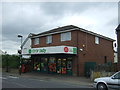
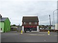
Living in CO1 2SR offers access to essential retail and transport hubs within practical reach. Nearby supermarkets include Lidl Colchester, Tesco Colchester, and Waitrose Colchester, providing convenience for daily shopping. The area’s rail network, with stations like Colchester Railway Station, connects residents to Colchester’s urban amenities, including cultural venues, healthcare facilities, and employment centres. Locally, the Greenstead Community Centre, established in 2003, serves as a focal point for social activities and events. Historic sites like St. Matthew’s church and Gallow Green add character to the area, though recreational parks or green spaces are not explicitly mentioned. The mix of retail, transport, and community facilities supports a self-contained lifestyle, with residents able to meet most needs without venturing far from home.
Amenities
Schools
| Rank | School | Type | Entry gender | Ages |
|---|
Explore more schools in this area
Go to Schools tabDemographics
The population of CO1 2SR is 1,364, with a median age of 47. Over half of residents are adults aged 30–64, reflecting a mature, settled community. Home ownership rates stand at 49%, indicating a mix of owner-occupied properties and rental housing. The area is predominantly composed of houses, suggesting a lower density of apartments or flats. The predominant ethnic group is White, though no specific data on diversity or deprivation levels is provided. This demographic profile implies a stable, middle-aged population likely prioritising long-term residency over transient housing. The absence of younger families or high student populations may influence local services and amenities, which are tailored to older residents. For buyers, this suggests a community with established routines and limited demand for childcare or educational facilities beyond basic provision.
Household Size
Accommodation Type
Tenure
Ethnic Group
Religion
Household Composition
Age
Household Deprivation
NS-SEC
Explore more demographic insights in this area
Go to Demographics tabPlanning
Planning Constraints
- Flood RiskPremium
- Ramsar Wetland SitesPremium
- Area of Outstanding Natural BeautyPremium
- Protected Nature ReservePremium
- Protected WoodlandPremium